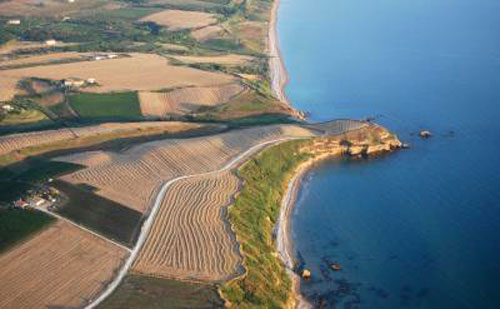
The protected area of Punta Aderci is the first reserve established in Abruzzo in the coastal strip, and was born from the need to reconcile the naturalistic aspect of the area with the marina on the usability of the beaches. The Reserve has an area of about 285 hectares (400 arriving in the area of external protection) and goes to the beach of Punta Penna, adjacent to the Port of Vasto (Punta Struggle), at the mouth of the river Sinello (border town Casalbordino).
The Natural Reserve of Punta Aderci, Vasto, Chieti, Abruzzo
In 2000, the City of Vasto adopted the Spatial Plan of Nature (PAN) of the Regional Nature Reserve Wizard Punta Aderci, developed by the Cooperative Cogecstre Penne, finally approved by the Regional Council on 25.09.2007.
In the Reserve, the flat area appears more populated, the agricultural landscape is traditional, with large vineyards, olive groves and vineyards planted mainly grasses. The area’s natural interests consists of the beach of Punta Penna: an amphitheater that hosts many marine plant species typical.
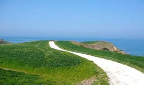
The promontory of Punta Aderci (26 m above sea level) characterizes the entire area offering a 360° view over the reserve. In some cavities of Punta Aderci you can admire the Halymenia floresia, considered the most beautiful in the Mediterranean red alga. From Punta Aderci views sweep the Maiella National Park, the Gran Sasso – Laga and Sibillini: at sunset, with good visibility, you can glimpse the Regional Park of Conero.
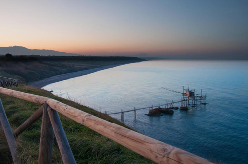
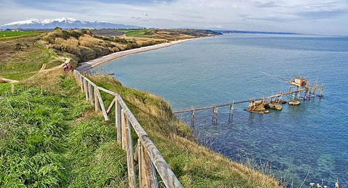
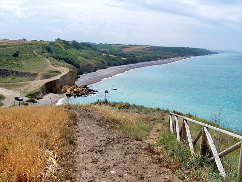
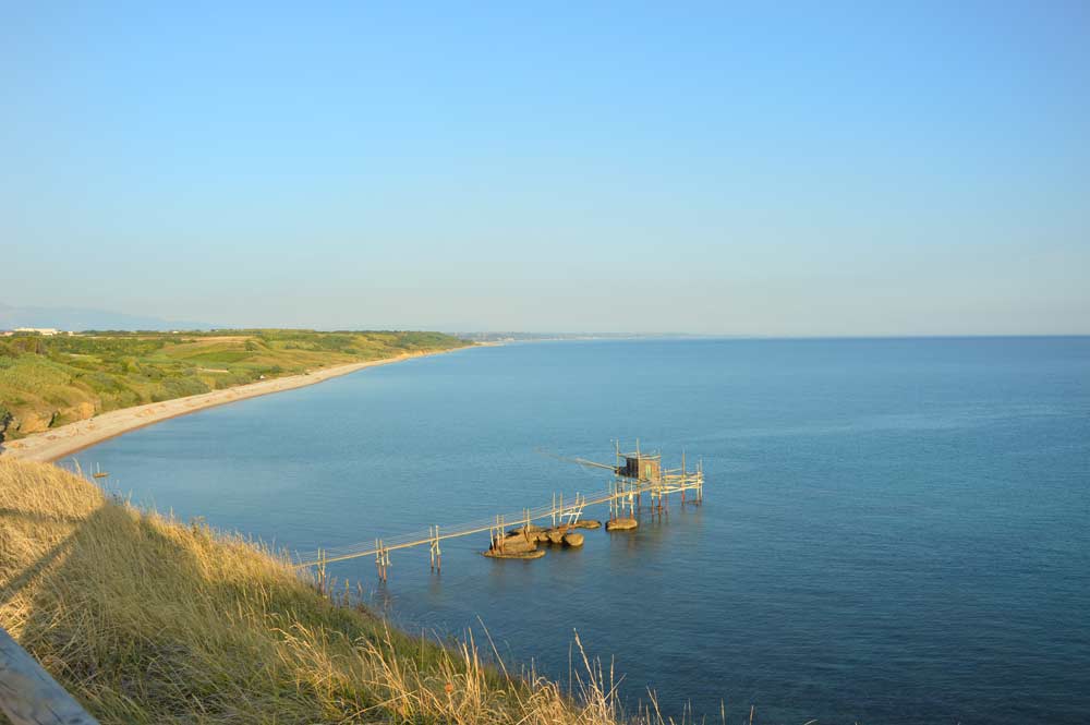
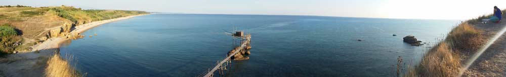
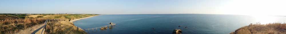
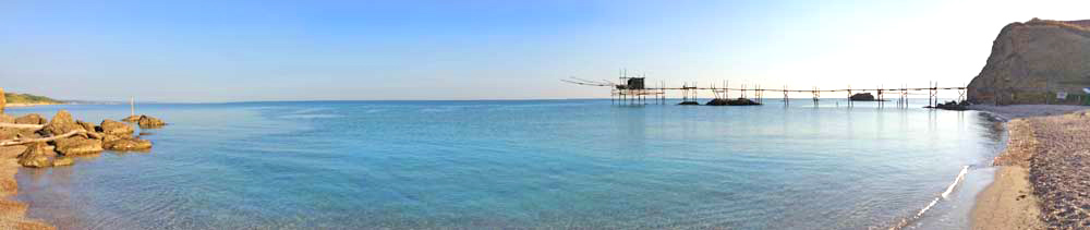
The long sandy beach of Punta Penna ends with the pebble beach of Libertini below the cliff of the promontory of Punta Aderci. The beach of Libertini is accessible both from the beach of Punta Penna, through a short path of 80 steps, which connects to the dirt road leading to the Punta promontory Aderci.
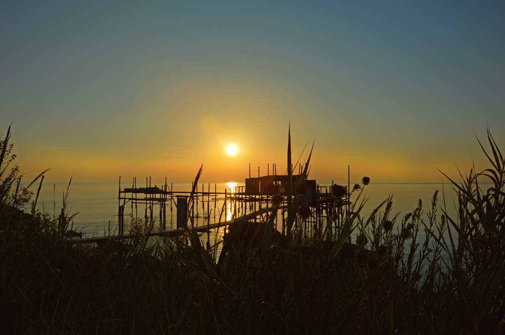
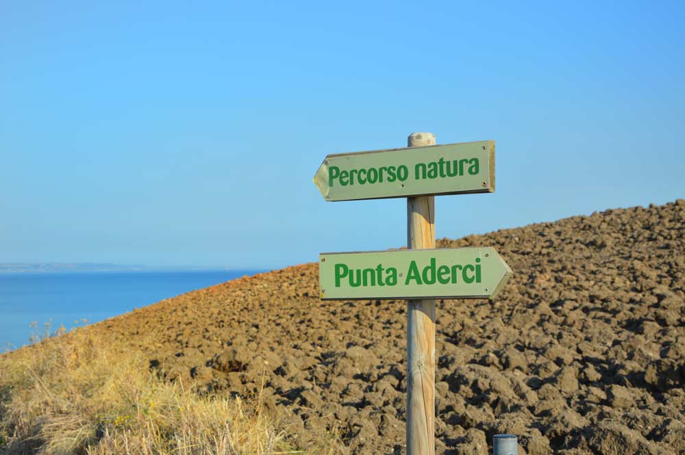
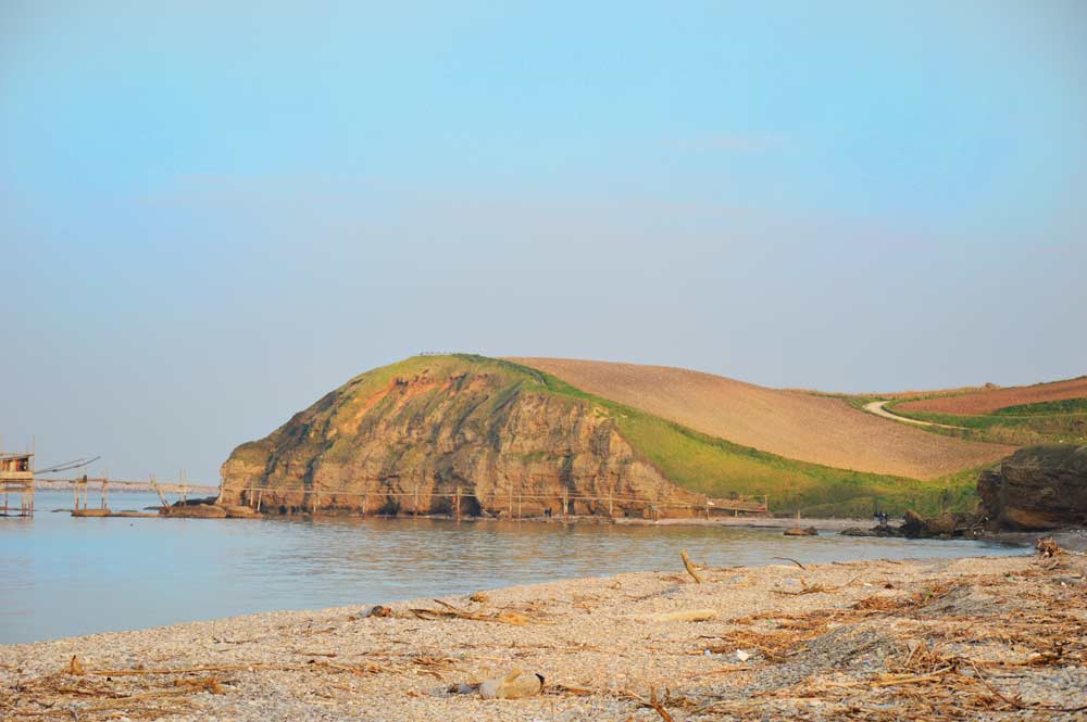
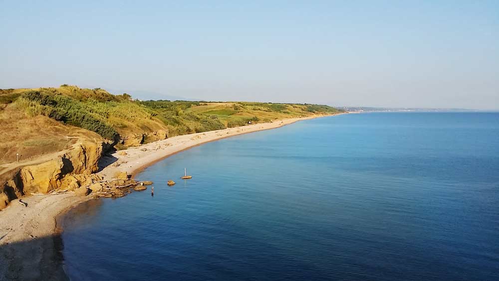
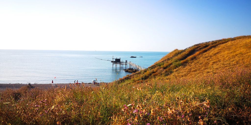
Photo Mila Caserio
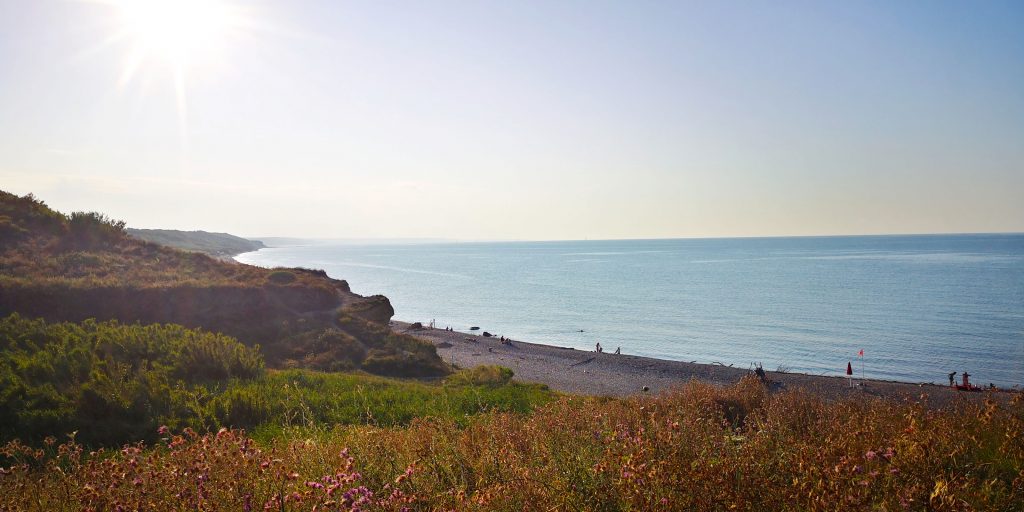
Photo Mila Caserio
 From here we continue along the long pebble
 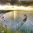 beach Mottagrossa. From the beach to the mouth of the river Sinello, begins one of the northwest coast of solitary and difficult to access the central Adriatic. Overlooking the beach Mottagrossa along a scenic route altitude (about 20m above sea level “sea level”) of about 3 km, (former railway line) that enables, on foot or by bike, to discover the pine forests of the sea, valleys and stretches of Mediterranean.
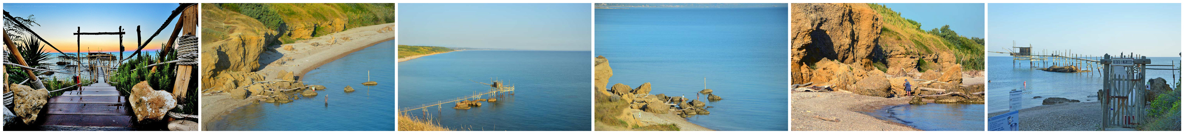
The pine forests offer visitors the chance of a refreshing break during the summer months. Reserve ends at the mouth of the river Sinello just beyond the features brick arches that marked the old railway line; continuing begins the waterfront of the city of Casalbordino.
Turning left, just before the mouth, move away from the coast along a path that runs along the river Sinello and running through the inner zone of the Reserve.
Le Dune
 The dunes are hilly structures characteristics of deserts and sandy shores. Those coastal run parallel to the coast, consist mainly of fine sediments inconsistent brought by rivers (fluvial) and waves (marine) Transporting and re-deposited sediments according to the mainstream. The dunes are not static structures; are unstable, are constantly moving and downsizing caused by the direction and strength wind of Punta-Aderci.
The wind, in fact, pushes the sand particles inland to drive or to leaps creating a windward side with moderate slopes and a leeward side slope steeper. Usually the slope of the dune facing the sea is most affected by the erosive action of the wind, while the protected side is increased by the accumulation of sand grains.
The sand begins to accumulate when it encounters rocks or plants. The vegetation thus has a fundamental importance for the formation of coastal dunes, since it creates an impediment to the progress of sand inland. It can begin the formation of embryonic dunes that are increasingly expanding and stabilized, to form real hills asymmetrical that can exceed 10 meters in height. The first dune, overlooking the sea, is always higher than those in the back.
Weld later, are richer in vegetation cover, represented by shrubs typical of the Mediterranean. The dune ridges environments are very interesting from the point of view of both ecological landscape. These ecosystems have a delicate balance evolutionary related to the ongoing transformation of the substrate caused by the erosion of wind and sea, making it difficult the settlement of plants and consequently their stabilization. Often makes matters worse is the action of the man with the construction of roads and buildings along the coast or simply, with just trampling plants growing in the dunes, on the balance described interferes causing the demolition of the dune ridges. But one of the greatest damage is definitely made by construction of dams upstream of artificial waterways. These have led to a drastic reduction in the transport of sandy sediments that reached the sea, causing the retreat of the beach. In Vasto this phenomenon is bucking the fact the beach is characterized by an active dynamic deposition and dune building, favored by the deposition of the pier to defend the port of Vasto.
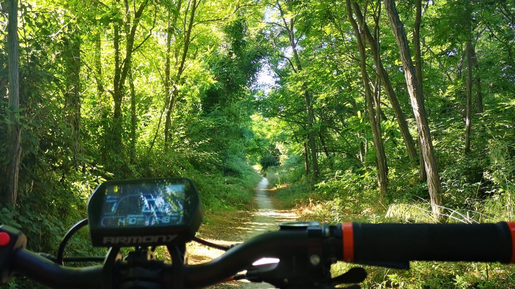
Photo Mila Caserio
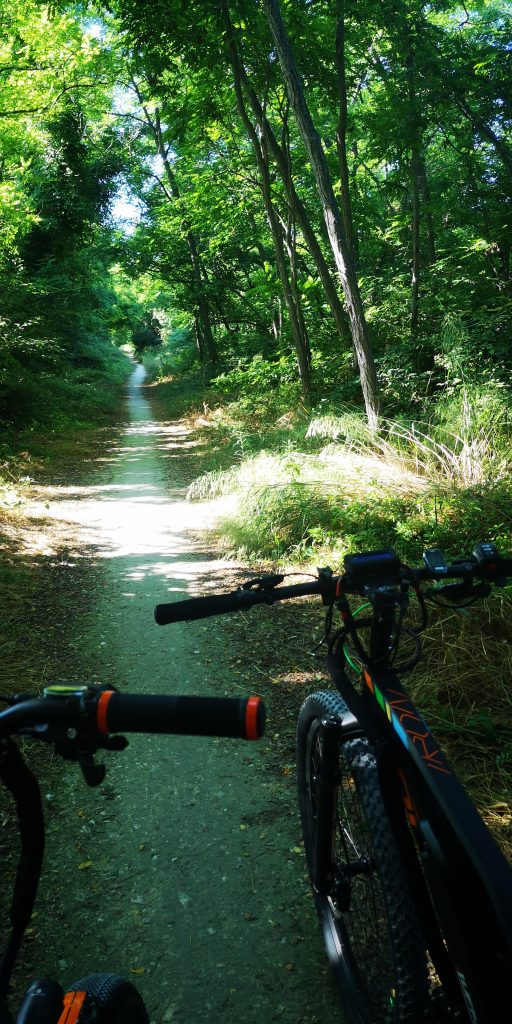
Photo Mila Caserio
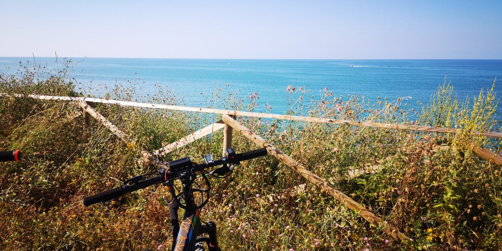
Photo Mila Caserio
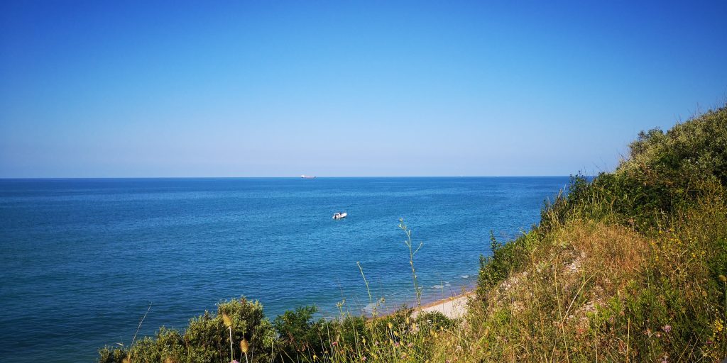
Photo Mila Caserio
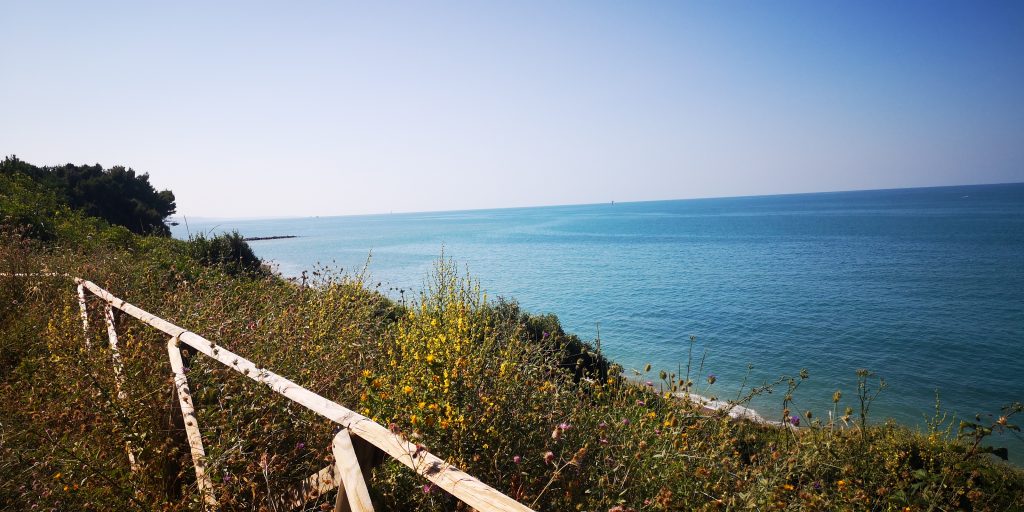
Photo Mila Caserio
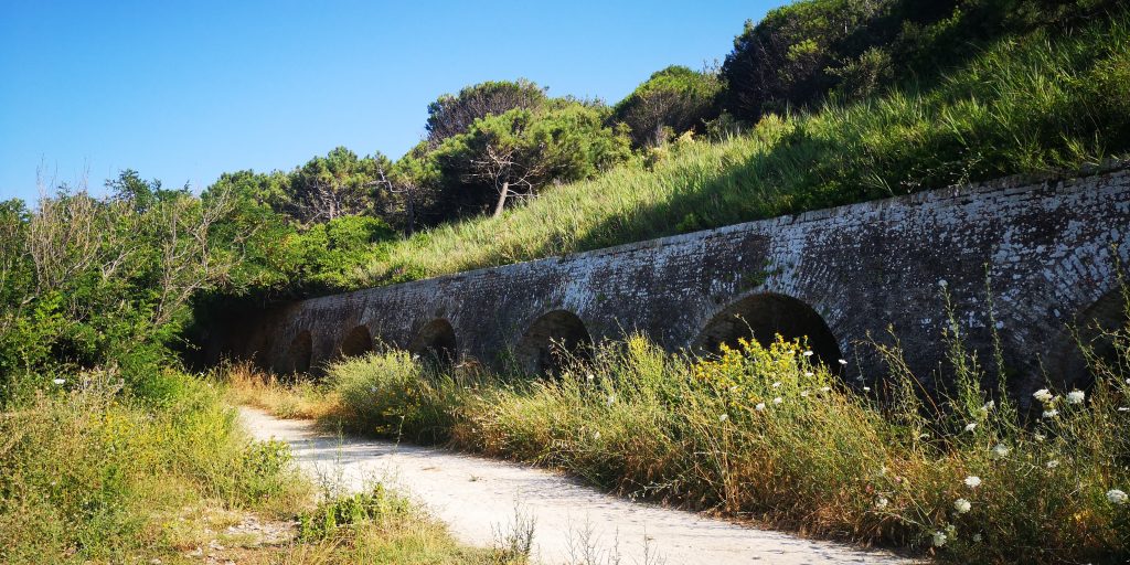
Photo Mila Caserio
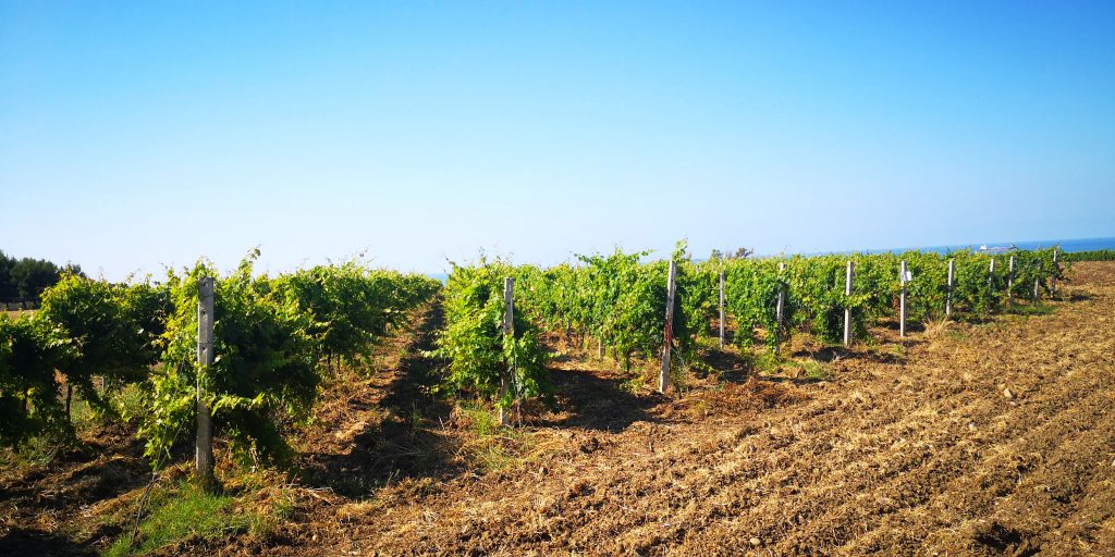
Photo Mila Caserio
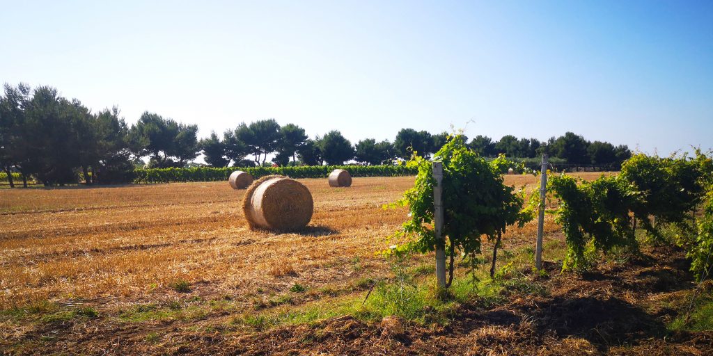
Photo Mila Caserio
Photo Mila Caserio
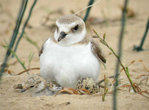
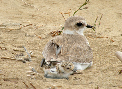
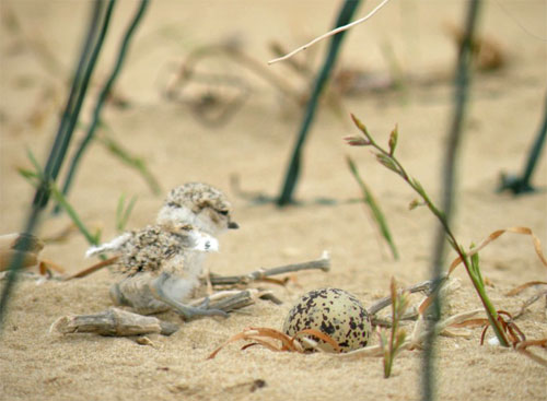
Measures to protect the nesting mallards
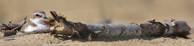
Conservation actions and the census of nesting mallards (Kentish Plover) are especially important, as this small wader is now a well-established biological indicator on the health of the dune environment. The proof is that a large part of the Adriatic coast every year, WWF organizes the “Kentish day” a day dedicated to the monitoring of this species with the help of volunteers and ornithologists. From this monitoring are obtained useful information to plan conservation projects residue dune environments.
Inside the reserve of Punta Aderci this has particular relevance as the Plover was chosen as a symbol of the Reserve; right from the first census on the coast of Vasto, in the late ’80s, (dune of Punta Penna and Marina di Vasto) over time has matured the idea of using the Kentish systematically as an environmental indicator. To protect the nesting mallards, due to numerous dangers to which it is exposed, (both during deposition and hatching of the eggs, which in the days before fledging of the young), the Reserve Punta Aderci tries to field ideas and projects for the purpose of effective protection. The public information and environmental education go hand in hand with the physical boundaries of the play at the foot of the dune.